Article contents
The Nizamiya Madrasa and Baghdad Topography
Published online by Cambridge University Press: 15 March 2011
Abstract

- Type
- Miscellaneous Communications
- Information
- Copyright
- Copyright © The Royal Asiatic Society 1928
References
page 610 note 1 As-Subkí, , ṭabaqát ash-sháfi'íya, iii, 90Google Scholar, also refers to the madrasa as standing on the Tigris bank.
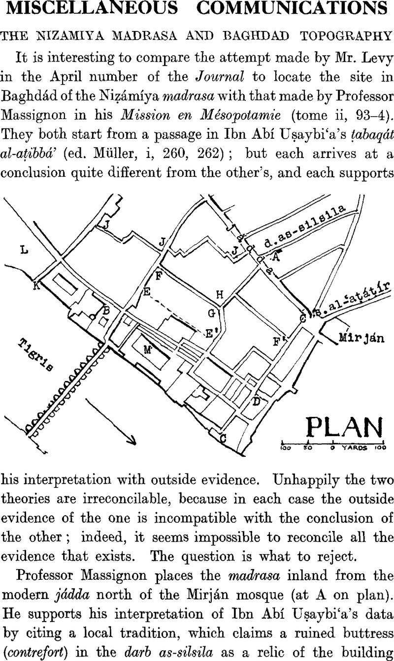
page 611 note 1 Surely Mr. Levy is mistaken in stating that the mashra'at al-maṣbagha leads to the bridge. The street leading to the bridge is called sharí'at al-jisr, according to Professor Massignon (loc. cit., No. 16), and both he and. recent maps show the maṣbagha as next down-stream.
page 612 note 1 Ibn Abí Uṣaybi'a's words “in the mashṛa'a running down to the Tigris bank” seem to refer rather to the Báb al-Gharaba than to the Amín's house.
- 1
- Cited by


