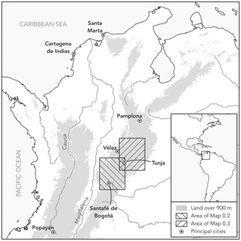
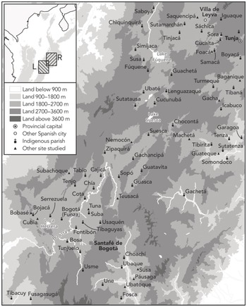
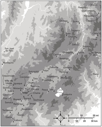
xviiMap 1 The Northern Andes, showing the principal Spanish cities of the New Kingdom of Granada and of the Archdiocese of SantaféFootnote 1 xviiiMap 2 The Province of Santafé and southern reaches of the Province of Tunja, c. 1650, showing cities, towns, and other settlements studied in this book xixMap 3 The central and north-eastern portions of the Province of Tunja, c. 1650, showing cities, towns, and other settlements studied in this book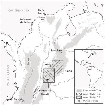
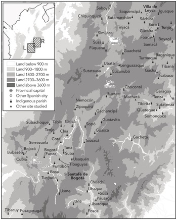
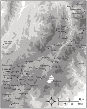
1 These maps attempt to show the sites and communities studied in this book across the highlands of the Northern Andes. In most cases, I have mapped them in the locations that they occupied by the middle of the seventeenth century – a pragmatic choice that reflects when documentation is most abundant, particularly Rodrigo Zapata de Lobera’s 1663 summary of the civil visitations of the first half of the seventeenth century (discussed in Chapter 6). I have tried to be exhaustive, but this has not been entirely possible because many sites are no longer extant today. Indeed, by 1663, many had already been abandoned, or amalgamated with their neighbours as a result of trends discussed in the chapters that follow. Where no location could be ascertained, I have tried to indicate an approximate location in relation to mapped sites and landmarks in the main text, where I also sought to distinguish between settlements with identical names. All maps were drawn by me, using ASTER Global Digital Elevation Data and the Diccionario Geográfico de Colombia and Colombia en mapas data sets of the Instituto Geográfico Agustín Codazzi (IGAC). I am grateful to Santiago Muñoz for his thoughtful feedback, as well as for information on the location of sites in the Valley of Ubaque, published in Costumbres en disputa .

