We use cookies to distinguish you from other users and to provide you with a better experience on our websites. Close this message to accept cookies or find out how to manage your cookie settings.
To save content items to your account,
please confirm that you agree to abide by our usage policies.
If this is the first time you use this feature, you will be asked to authorise Cambridge Core to connect with your account.
Find out more about saving content to .
To save content items to your Kindle, first ensure no-reply@cambridge.org
is added to your Approved Personal Document E-mail List under your Personal Document Settings
on the Manage Your Content and Devices page of your Amazon account. Then enter the ‘name’ part
of your Kindle email address below.
Find out more about saving to your Kindle.
Note you can select to save to either the @free.kindle.com or @kindle.com variations.
‘@free.kindle.com’ emails are free but can only be saved to your device when it is connected to wi-fi.
‘@kindle.com’ emails can be delivered even when you are not connected to wi-fi, but note that service fees apply.
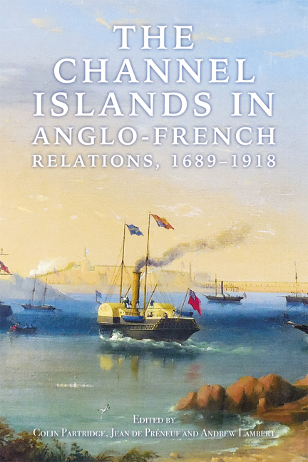
Renowned landscape historian Michael Symes explores the history and techniques of printmaking and how prints of landscape gardens reflected and influenced fashion - sometimes at the expense of reality.
These probate inventories describe the houses, furniture, farming and clothing for different social groups, including widows, in sixteenth century and seventeenth century Bedfordshire.
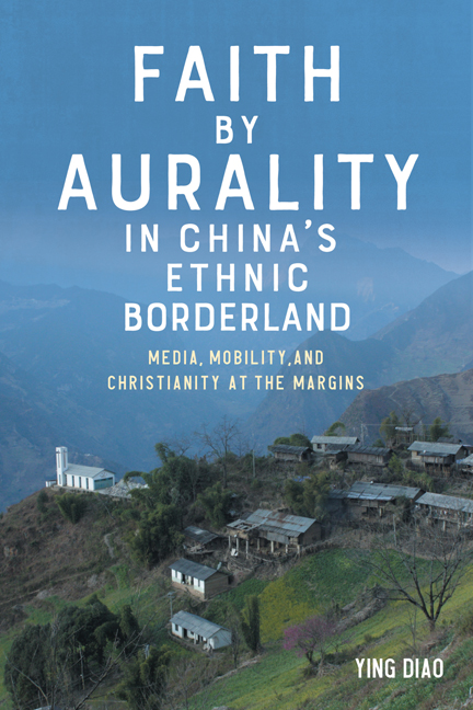
Illuminates how voice, faith, and hearing become intertwined with technologies of sound reproduction and mobility amid the rapidly transforming religious landscape of China's ethnic borderland.
An edition of the first part of the Account and Memoranda Book compiled by William Porlond, clerk to the Brewers' Company (1418-40), translated and made available for publication for the first time.
Drawing upon a surprising wealth of evidence found in surviving manuscripts, this book restores friars to their rightful place in the history of English health care.
Oxford Town and Gown came together in 1771 as Paving Commissioners, the city's principal local government body. Within thirty years this collaboration transformed Oxford from a medieval to a modern city.
An investigation of English and Scottish dream visions written on the cusp of the 'Renaissance', teasing out distinctive ideas of authorship which informed their design.
This article examines the religious life of the suburban Oxford parish of Cowley St John in the second half of the nineteenth century. It contrasts the ministry of a well-resourced and visionary Anglican vicar with a Nonconformist mission supported largely by ordinary people of the ‘middling sort’ who were determined that their beliefs should be promoted too. The Nonconformist mission left few lasting traces but this study reveals a more competitive Victorian religious world in Oxford than may be supposed from a superficial comparison of written or architectural legacies.
Christianity was easily the dominant faith of Victorian Britain but it was also ‘much more disunited and quarrelsome than it is now’. One important strand of Victorian Christian faith was represented by the Evangelicals. Ripples from the Evangelical revival of the eighteenth century had spread over into the 1800s: existing denominations were reinvigorated and new ones were born. Those holding to Evangelical theology could be found within the Church of England as well as many Dissenting or Nonconformist groups, including Baptists, Independents, Methodists and Congregationalists, who all agreed about the doctrines of the Trinity, the inspiration and authority of Scripture, human sinfulness and the justification of sinners by faith through the agency of the Holy Spirit, amongst other doctrines. The proportion of churchgoers who joined Dissenting congregations increased from about 10 per cent in 1790 to almost 50 per cent by 1851. Often, different Evangelical groups could overcome their differences and work together, as will be illustrated later.
The Tractarians represented a very different tradition. In the 1830s, the Oxford Movement burst onto the religious scene via a series of tracts on theological matters written by Oxford University academics, including John Henry Newman, Edward Bouverie Pusey and John Keble. Tractarians endeavoured to restore the Catholic heritage of the Anglican Church, asserting that the nineteenth -century Anglican Church was still, essentially, Catholic. As the century progressed, followers of the Oxford Movement often adopted more elaborate ceremonial ritual. Such ostentatious harking back to medieval Catholicism provoked the ire of many Protestants, especially when it coincided with the re-establishment of the Roman Catholic hierarchy in England and Wales (in 1850).
The Tractarian ministry differed greatly, and very visibly, from that of the Evangelicals. The Tractarians worked towards building a Eucharistic community, whilst the Evangelicals sought to build God’s kingdom soul by soul.
Archaeological excavations in 2015 to the east of Southam Road, Banbury revealed Neolithic occupation evidenced by two episodes of pit digging (separately associated with Grooved Ware and probable Peterborough Ware pottery). A substantial subcircular ditched enclosure can only be broadly attributed to the later Bronze Age. Within the enclosure, remains of post-built roundhouses, gullies, and small pits had suffered truncation from historical ploughing but indicate a settlement function. However, the precise chronology of its development is uncertain due to the limited quantity of datable finds, and their concentration in a small number of contexts. Later periods are represented by three cremation-related features dated to the Romano-British period, as well as a medieval hollow way and traces of ridge and furrow cultivation associated with Hardwick deserted medieval village, which lies immediately south of the site. Other ditches indicate land division of more than one phase, though these were not securely dated.
The excavations to the east of Southam Road, sponsored by Bellway Homes Limited, formed the final phase of a programme of archaeological work undertaken by Wessex Archaeology between 2011 and 2015, prior to the development of the land for housing called Hanwell View. A desk-based assessment was initially carried out, followed by geophysical survey which identified a large subcircular enclosure in the south-east of the site, along with other anomalies of potential archaeological interest and linear trends from ridge and furrow. Subsequent trial trenching uncovered ditches, gullies, pits and postholes in twenty-five of the fifty-five excavated trenches. Though most features did not yield datable finds, a Neolithic pit containing a large quantity of Grooved Ware pottery was excavated, along with several ditches and gullies, which produced small amounts of Bronze Age and Romano-British pottery, as well as worked flint. A trench targeted on the south-west quadrant of the large subcircular geophysical anomaly revealed a ditch containing middle Bronze Age pottery, though the evaluation did not identify the eastern extent of the predicted enclosure.
Following consultation with the Planning Archaeologist for Oxfordshire County Council and archaeological advisor to Cherwell District Council, a mitigation strategy proposing five separate excavation areas (A–E) was approved. The excavation was undertaken between February and March 2015 during challenging weather conditions, including rain and snow. An initial assessment of the excavation results, incorporating proposals for further analysis and publication, was produced in September 2015.
Oxford Archaeology (OA) was commissioned by Austin Newport Ltd, on behalf of New College, to undertake an archaeological investigation ahead of development at the Morris Building on Longwall Street (Fig. 1). Following an earlier evaluation, an archaeological strip, map and sample excavation was carried out during the course of the groundworks between August and November 2017. This report summarises the main results of the excavation; the full report is available to download from the OA Library.
The area of development, formally a gravel courtyard to the rear of the Morris Building located at grid reference SP 5192 0645, encompasses an area of c.170 sq m. The site lies at about c.60.40 m above Ordnance Datum (OD). The site lay within the footprint of the defensive ditch of medieval Oxford. The extant thirteenth century city wall lies about 10 m to the south, immediately to the west of a bastion that formed the north-east corner of the town defences. It is believed to follow the line of the late Anglo-Saxon burh defences or its postulated eastward extension. During the thirteenth century or later a second line of stone defences were added, c.10 m in front of the town wall. Excavations undertaken by Brian Durham during earlier redevelopment of the former Morris Garage site revealed a 1.0-m thick stone wall corresponding with the southern boundary wall of the present site and a projecting bastion on its north-east corner, both constructed over the partially backfilled town ditch.
The maps of Agas (1578) and Speed (1610) depict the intact city walls and ditch but do not indicate the outer stone wall which is shown intact on Loggan’s map of 1675. It is speculated that the outer wall was repaired and the ditch to the north was recut during the Civil War, though by the time of Loggan the ditch had been infilled and both sides of the newly Holywell Street built up. The area of the site appears to have remained open until at least 1750 when Taylor shows the site as a garden with a small house on the Holywell Street frontage.
In the nineteenth century the land was occupied by the printing office of Jackson’s Oxford Journal with the rear of the site occupied by livery stables.
This year saw a return to the pattern of major college developments within the historic core of Oxford with institutions seeking to expand within heavily confined sites. At both Frewin Hall (Brasenose College) and Castle Hill House (St Peter’s College) physically constrained evaluations undertaken before planning consent was granted were unable to fully characterise the complexity of the archaeology present. The result in both cases being the identification and recovery of unexpected and exciting archaeology during the excavation phase of these projects. The Brasenose College site was notable for capturing the public imagination with press releases celebrating the investigation of the ‘lost college’ of St Mary’s and a successful open day followed by television slots on the local news and BBC’s Digging for Britain. Subsequently Oxford Archaeology received an Oxford Preservation Trust certificate for their work at the site.
The year also saw careful evaluation work around the former Blackfriars church to ensure that any future development avoids the medieval burial remains in that area. Elsewhere, evaluations revealed significant new information at Littlemore Priory, providing insights into the layout of the Nunnery precinct, and at the large Oxpens site located west of the Ice Rink, providing information on the character of Oxford’s western floodplain and hinterland. Short summaries of selected investigations from 2022 are provided below.
SELECTED PROJECTS
Brasenose College, Frewin Hall, New Inn Hall Street
Between January and March an excavation was undertaken by OA in the garden of Frewin Hall, with follow up work on service trenches continuing into May (Fig. 1). In addition to a large well-built wall foundation, likely the remains of the south range of the quadrangle of the fifteenth- to sixteenth-century Augustinian St Mary’s College, the excavation revealed several medieval stone structures including two kitchen areas, stone-lined waste pits, boundary walls, foundations with distinctive relieving arches, and a large stone-built cellared building. A remarkable discovery at the northern end of the site was the remains of an upstanding Bronze Age barrow mound and associated ditch. This had been cut into by pits and subsumed by later build-up. A mid to late Anglo-Saxon semi-cellared building was cut into the barrow, with probable evidence of destruction from fire and another pit containing likely redeposited human bone that has produced an intriguing eighth- to ninth-century AD radiocarbon date (Fig. 2).
The Uffington White Horse is a well-known and unique prehistoric chalk hill figure. It was mentioned in the Middle Ages and celebrated in the eighteenth and nineteenth centuries but only reliably dated in 1996. Its purpose remains unknown. Theories have included that the horse figure was either a tribal emblem or was influenced by the horse symbols depicted on early British Iron Age coins, buckets and pots, or else that it commemorated an Anglo-Saxon victory over the Danes. This new analysis demonstrates the hill figure’s intimate relationship with the winter solstice sunrise, identifying its functionality as a prehistoric winter solstice observatory of some sophistication. The likely evolution of this role over time within its landscape context is described and documented astronomically.
The Uffington White Horse is the largest ancient hill figure in Europe and the first scientifically dated example existing in Britain. It is a dynamic figure aligned with the rising Sun, galloping uphill on the shoulder of the eponymous Whitehorse Hill towards its summit immediately to the south. While long recognised as the somewhat abstract representation of a horse, the hill figure is also unnaturally elongated, closely paralleling the rising visible horizon of the hillside. The figure extends 110 metres by 33 metres across the scarp of the downs in an open and visually prominent setting. Its construction – as a carefully delineated, largely linear excavated profile, cut into the hillside and filled with imported and compacted chalk – has been dated by optically stimulated luminescence testing to between 1740 and 210 BC with 95 per cent confidence (Fig. 1).
The figure forms part of a cluster of archaeological and landscape elements south of the village of Woolstone: the White Horse itself, the Whitehorse Hill summit, the Long Mound and Round Barrow, Woolstone Wells and Dragon Hill. These are located between the Ridgeway and the Icknield Way, two ancient trackways which closely approach each other at this point. In addition, there are two nearby enclosures, Uffington Castle, a prominent late Bronze Age/ early Iron Age hill fort on Whitehorse Hill, actively used until the Romano-British period, and Hardwell Camp, further down the scarp to the west (Fig. 2).
Referred to in the twelfth century as fifth in a list of the Wonders of Britain, the White Horse was evidently then already recognised as being a well-established feature of the landscape.